USA Road trip 2014 - Page 10
About 11 pm, Sue discovered this scary weather warning that included the area we are camping in!
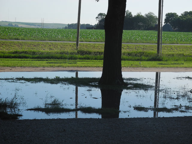
We had a rather anxious night but the storm front missed us, we did have 3 inches of rains in extremely heavy down pours.
Here is the weather warning for those that have not been thorough such a storm.....
Severe Thunderstorm Warning in Eastern Nebraska
A Severe Thunderstorm Warning remains in effect until
11:00 pm CDT for Western Colfax, Eastern Platte and Northwestern Butler
counties. At 10:39 pm CDT, a severe thunderstorm was located about 8 miles
south southwest of Columbus, moving northeast at 35 mph. Quarter size hail
and wind gusts of 60 mph is possible from this part of the storm. Another
part of the storm northeast of Richland had weakened a little but was still
capable of producing small hail and wind gusts of 40 or 50 mph.
Hazard, 60 mph wind gusts and quarter size hail.
Source, radar indicated.
Impact: hail damage to vehicles is expected. Expect wind
damage to roofs, siding and trees.
Locations impacted include: Columbus, Schuyler, Bellwood,
Rising City, Duncan, Platte Center, Monroe, Richland, Tarnov, Lake
North Babcock campground (US!!!), Camp
Pawnee, Camp Luther, Central Community College. Lake Ocaonee, Shell Creek
Elementary School, College View trailer park and circle H trailer park.
This includes the following highways. Highway 30 in
Nebraska between mile markers 366 and 399.
Highway 81 in Nebraska between Milemarkers 110 and 130.
Highway 92 in Nebraska between mile markers 409 and 412,
and near mile marker 409.
A Tornado Watch remains in effect until 12:00 am CDT
Sunday morning for West Central Iowa and eastern Nebraska.
Wind, 60mph.
Recommended actions:
For Your Protection move to an interior room on the
lowest floor of a building.
Before:
·
To begin preparing, you should build an emergency kit and make a
family communications plan.
·
Remember the 30/30 Lightning Safety Rule: Go indoors if, after
seeing lightning, you cannot count to 30 before hearing thunder. Stay
indoors for 30 minutes after hearing the last clap of thunder.
·
Secure outdoor objects that could blow away or cause damage.
·
Get inside a home, building, or hard top automobile (not a
convertible). Although you may be injured if lightning strikes your car, you
are much safer inside a vehicle than outside.
·
Shutter windows and secure outside doors. If shutters are not
available, close window blinds, shades or curtains.
·
More about what
to do before thunderstorm and lightning.
During:
·
Avoid contact with corded phones and devices including those
plugged into electric for recharging. Cordless and wireless phones not
connected to wall outlets are OK to use.
·
Avoid contact with electrical equipment or cords. Unplug
appliances and other electrical items such as computers and turn off air
conditioners. Power surges from lightning can cause serious damage.
·
Avoid contact with plumbing. Do not wash your hands, do not take a
shower, do not wash dishes, and do not do laundry. Plumbing and bathroom
fixtures can conduct electricity.
·
Stay away from windows and doors, and stay off porches.
·
If you are driving, try to safely exit the roadway and park. Stay
in the vehicle and turn on the emergency flashers until the heavy rain ends.
Avoid touching metal or other surfaces that conduct electricity in and
outside the vehicle.
·
More about what
to do during thunderstorm and lightning.
What is a Severe Thunderstorm Warning?
This is issued when either a severe thunderstorm is
indicated by the WSR-88D radar or a spotter reports a thunderstorm producing
hail one inch or larger in diameter and/or winds equal or exceed 58 miles an
hour; therefore, people in the affected area should seek safe shelter
immediately. Severe thunderstorms can produce tornadoes with little or no
advance warning. Lightning frequency is not a criteria for issuing a severe
thunderstorm warning. They are usually issued for a duration of one hour.
They can be issued without a Severe Thunderstorm Watch being already in
effect.
Like a Tornado Warning, the Severe Thunderstorm Warning
is issued by your National Weather Service Forecast Office (NWFO). Severe
Thunderstorm Warnings will include where the storm was located, what towns
will be affected by the severe thunderstorm, and the primary threat
associated with the severe thunderstorm warning. If the severe thunderstorm
will affect the nearshore or coastal waters, it will be issued as the
combined product--Severe Thunderstorm Warning and Special Marine Warning. If
the severe thunderstorm is also causing torrential rains, this warning may
also be combined with a Flash Flood Warning. If there is an ampersand (&)
symbol at the bottom of the warning, it indicates that the warning was
issued as a result of a severe weather report.
After it has been issued, the affected NWFO will follow
it up periodically with Severe Weather Statements. These statements will
contain updated information on the severe thunderstorm and they will also
let the public know when the warning is no longer in effect.
Source: weather.gov
Other alerts in this area
·
Tornado Watch in Nebraska
National Weather Service - updated 5 hours 35 mins ago
·
Tornado Watch in South Central Nebraska
National Weather Service - updated 2 hours 1 min ago
·
Flash Flood Watch in Eastern Nebraska
National Weather Service - updated 7 hours ago
10:15pm: CONFIRMED
TORNADO in Hamilton County, NEB. Take shelter NOW in GILTNER, NEB.pic.twitter.com/yBEpR9QqEd

Our view the morning after the event.....

More wind turbines in Iowa than we have seen so far....

Owner MidaAmerican Energy

Bruce celebrating Father's Day at Rock Creek Iowa
|
|
( |
|
® Design by Whitehouse Ink |
|